Grecia White
Recent Posts
Looks Like Memorial Drive Will Remain Open On Saturdays After All
| | No Comments
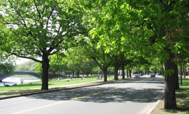
There won’t be any changes in the operating hours of Cambridge’s popular car-free weekends on Memorial Drive, even though the state Department of Conservation and Recreation (DCR) gave its fans a scare last week when it unexpectedly announced that it was planning to let car traffic back in on Saturdays. Such incredibly disappointing news. We'll […]
Weekend Construction Work On the Southwest Corridor Set to Overlap with Start of Orange Line Shutdown
| | No Comments
The Department of Conservation and Recreation, DCR, the managing state agency for the Southwest Corridor, will “implement moving closures along the Southwest Corridor Park bike path in the City of Boston to accommodate repair work” during the first weekend of the Orange Line shutdown. @MassDCR has issued the following UPDATED recreational advisory for the Southwest […]
La Línea Naranja Cierra El Viernes: Lo Que Necesita Saber
| | No Comments
La Línea Naranja es la segunda línea de tránsito rápido más usada de la T.
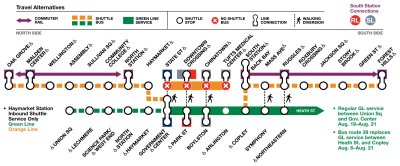
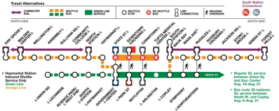
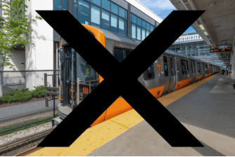
Orange Line Shutdown: Here’s What You Need to Know
| | No Comments
The entire Orange Line and a downtown segment of the Green Line will shut down for a month starting this weekend, and the MBTA and coordinating agencies in state and local governments are scrambling to nail down the details for alternative transit services. The Orange Line is the T’s second-busiest rapid transit line. Post-pandemic ridership […]
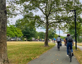
Biking with Mayor Wu and Exploring Biking as Alternative to Orange and Green Line During Upcoming Closures
| | No Comments
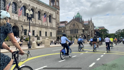
Early this Thursday morning over 50 community members gathered in the neighborhood of Roslindale to bike alongside Mayor Michelle Wu from Adams Park to City Hall in downtown Boston. The group rode together through various neighborhoods including Jamaica Plain and Back Bay with some folks dropping off or joining at various during the nearly 7 […]
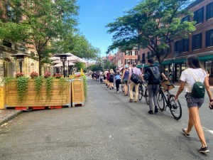
Photos: Open Streets Event in Roxbury Neighborhood
| | No Comments
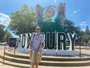
This past Saturday, the City of Boston hosted its second Open Streets event in the neighborhood of Roxbury along a stretch of Blue Hill Avenue from Warren Street to Dudley Street. The event temporarily closed off a section of Blue Hill Avenue to traffic and opened it to families, people on bikes, and anyone else […]
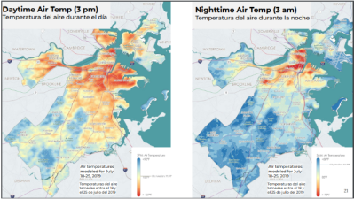
How Boston Plans to Cool Down Streets Amidst Rising Temperatures
| | No Comments
The City of Boston has several projects in the works as part of an ongoing Climate Ready Boston initiative in response to the changing climate patterns we’ve been experiencing and which are only expected to increase in frequency and severity, but the projects seem to miss a key connection between heat and transportation.
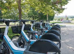
Latest Round of Street Grants Focus on Safe Streets, Bikeshare Expansions, and Snow Removal
| | No Comments
This latest round of grants awarded $16.4 million, the largest amount so far, primarily supports efforts grounded in making streets safer for everyone by reducing vehicle speeds and also investing in the equipment municipalities need to maintain their streets and facilitate safe active transportation.
La MBTA Cerrará la Línea Naranja Por Completo Durante 30 Dias Empezando el 19 de Agosto
| | No Comments
La MBTA está considerando tomar un paso nunca antes visto al cerrar la Línea Naranja por completo durante varias semanas a finales de Agosto para abordar la larga lista de peligros de seguridad y mantenimiento en sus vías.
Bike Union Protest Creates ‘People-Protected’ Bike Lane Across Beacon Hill
| | No Comments
This morning, the Boston Cyclists Union created a “people-protected bike lane” to call attention to the need for safer bike infrastructure through Beacon Hill to complete the promised Downtown Bike Network – a pre-pandemic City of Boston initiative that’s yet to fully materialize. At least a hundred participants gathered in solidarity to form a human-protected […]
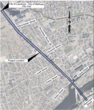
Proyecto en Lawrence Completaría Un Sendero Apartado de Calles Desde Merrimack River Hasta la Frontera de New Hampshire
| | No Comments
El proyecto Lawrence-Manchester Rail Corridor activaría un tramo de 1.4 millas del camino de tren abandonado Boston y Maine en Lawrence, desde Merrimack Street al sur del Merrimack River hasta el actual Methuen Rail Trail en la línea entre las ciudades de Methuen y Lawrence.

Lawrence Project Will Complete An Off-Street Path From Merrimack River to NH Border
| | No Comments
The Lawrence-Manchester Rail Trail project would activate a 1.4 mile stretch of the abandoned Boston and Maine railroad corridor in Lawrence, from Merrimack Street on the south side of the Merrimack River to the existing Methuen Rail Trail at the Methuen/Lawrence city line.