Christian MilNeil
Recent Posts
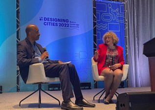
An Inside Look at Federal Highway Officials’ Efforts to Encourage Safer Streets
| | No Comments
The annual conference of the National Association of City Transportation Officials (NACTO) conference in Boston earlier this month offered a sort of homecoming for Stephanie Pollack, the former leader of MassDOT who left for Washington in early 2021 to lead the Federal Highway Administration in President Biden’s administration. Pollack’s return to Massachusetts coincided with the […]
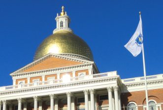
Gov. Baker Sends Traffic Safety Bill Back to Legislators With Objections to Safer Speed Limits and Passing Rules
| | No Comments
The Governor proposed several amendments, including a simpler 3-foot minimum distance for motor vehicles passing bikes and pedestrians, and striking language that would let cities and towns reduce speed limits to 25 mph on state-owned roadways, including the Department of Conservation and Recreation's dangerous "parkways."
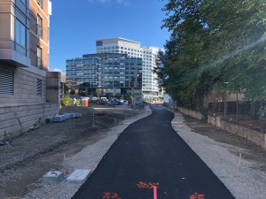
Eyes On the Street: The Fenway Multi-Use Path Inches Eastward
| | No Comments
The project connects to another path segment that runs behind the Landmark Center complex and opened last fall. That segment, which runs along the Green Line tracks east of the Fenway stop, currently ends at Miner Street.
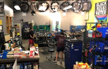
Volunteer Nights Have Returned at Bikes Not Bombs
| | No Comments
Volunteer work at Jamaica Plain's nonprofit bike shop doesn’t require any previous experience with bike repair, but it can serve as a good introduction for novices to gain some familiarity and experience with bike tools and parts.
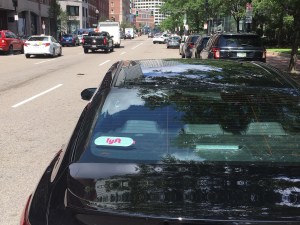
State Data Show Uber and Lyft Drivers Were Involved in Over 1,000 Crashes in the City of Boston Last Year
| | No Comments
A state compilation of Uber and Lyft data from 2021 data indicates that those companies' drivers were involved in 2,267 crashes across Massachusetts last year. Nearly half of those crashes – 1,098 – occurred in the City of Boston.
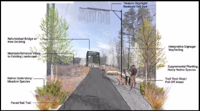
Planning Underway for Mass. Central Rail Trail Link Over I-95 in Waltham, Weston
| | 1 Comment
The proposed trail is less than a mile long, but it would connect two much longer MCRT segments in Waltham and Weston.
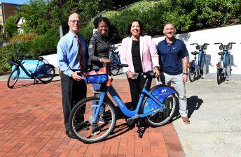
Salem Doubles Its Bluebikes Coverage
| | No Comments
The new stations will expand Bluebikes coverage into neighborhoods north and west of the downtown area, and supplement existing docks in high-ridership locations like Salem State University and the MBTA regional rail stop.
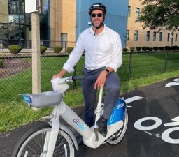
Boston Officials Test-Drive New Electric Bikes for Potential Inclusion in the Bluebikes System
| | No Comments
"We're looking at what it would take to add e-bikes to the Bluebikes system, and I wanted to try out the hardware," says Boston's Chief of Streets, Jascha Franklin-Hodge.
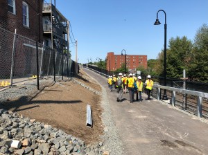
Photos: A Construction Tour of Somerville’s Community Path and New Light Rail Line
| | No Comments
During last week’s NACTO conference in Boston, attendees streamed out of the Hynes Convention Center each morning for “walkshops” that offered tours of some of the region’s pedestrian, bike, and transit infrastructure. One of those walkshops offered a hard-hat construction tour of the Somerville Community Path Extension, which is nearing the end of its construction […]
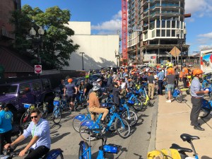
NACTO Comes to Boston
| | No Comments
While the transportation engineering profession generally has a reputation for neglecting anyone who isn't inside a motor vehicle, NACTO's members are working to change that culture.
Mayor Wu Announces Major Expansion of Boston’s Bike Network
| | No Comments
At a press conference in Roxbury this morning, Boston Mayor Michelle Wu announced that the city would undertake a major expansion in the city’s network of separated bike lanes, with a goal to put 50 percent of the city’s population within a 3-minute walk of a protected bike lane within the next three years. “We […]
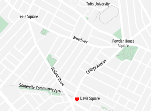
Somerville to Build Protected Bike Lanes Near Davis Square After Fatal ‘Dooring’ Crash
| | No Comments
Holland Street is scheduled to be repaved this fall; until this week, the project would have created a single paint-only bike lane next to parked cars, similar to the street layout on nearby Broadway.